


BayernInfo Maps
BayernInfo Mapsの説明
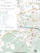
BAYERNINFO MAPS は、「車のルート計画」と「バスと電車の旅行情報」を 1 つのアプリで提供し、しかもすべて無料です。
途中でサプライズが発生することはめったにありません。建設現場、閉鎖、遅延を事前に知ることは、ストレスを軽減し、移動コストを削減することを意味します。また、途中で何か不測の事態が発生した場合でも、代替ルートの推奨事項が常に手元にあります。
BAYERNINFO MAPS は、旅行を計画するための最も重要な情報を提供します。
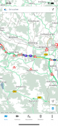
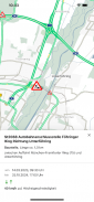
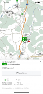
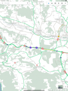
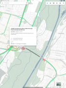
- バイエルン州全体のすべての既知の建設現場、閉鎖、交通情報を含む現在の交通状況
- バイエルン州および近隣地域の高速道路、国道および州道に沿った約 500 台の交通カメラからの画像 (ヨーロッパでの現在の開発のため、交通カメラからの画像は、追って通知があるまで限られた範囲でのみ利用可能です)
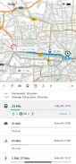
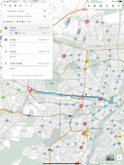
- 車、バス、電車のインターモーダル ルート プランニング、ご要望に応じてパーク & ライド、自転車、歩行者も
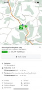
- 停留所と POI - 現在の出発時刻と公共交通機関の遅延
・携帯版の工事現場カレンダー
- ルートの概要: 選択したルートの現在の遅延時間が一目でわかる
最後に、アプリが特定の権限を必要とする目的について簡単に説明します。
- 正確な位置情報 (GPS): 自分の位置を表示したり、自分の場所から / への経路を指定したりするために必要です
- 完全なインターネット アクセス: サーバー側のサービス (地図、場所、ルート検索) にアクセスするために必要です。
・保護メモリへのアクセス:地図データのキャッシング(中間保存)に必要
バイエルンインフォ プロジェクトのサービスは、欧州連合から共同出資されました。
BAYERNINFO MAPS - モバイル情報 - 途中でリラックス - 無事に到着
BayernInfo Maps- APK情報
APKバージョン: 4.8.3パッケージ: com.ptvag.vib.bayerninfoBayernInfo Mapsの最新バージョン
他のバージョン


同じカテゴリのアプリ


